For years I’ve thought about riding this trail from Seattle to Idaho. This presents 2 challenges. First, how to cross the Columbia River? The bike/walk bridge south of the I-90 bridge was condemned and closed, and there is no other way to cross the river on foot or bike. Second, it’s over 300 miles which means multiple days of planning, logistics to get back home, and availability of hotels/motels east of Othello is virtually non-existent, and camping would mean carrying a bunch of extra gear.
The WA state Dept. of Transportation solved the first challenge. They rebuilt the Beverly bridge and it re-opened earlier this year. This put the trip entirely into my own hands.
Planning: A Short Route
A short route of only 1-4 days out and back seemed the simplest approach. I planned trip legs from Seattle to Idaho, each day covering 60-80 miles. Since there is no lodging available east of Othello, that would be the eastern-most point for my short route.
Ellensburg to the Columbia River / Beverly bridge along the JWT is about 35 miles. And it’s another 38 miles to Othello. This gives 2 equal distance options:
1-day: Ellensburg to Beverly and back (70 miles). Just cross the river and return.
2-day: Ellensburg to Othello, stay overnight in Othello, then return the next day. 73 miles each day for 146 total.
I opted for the 2-day trip.
This would require overnight parking in Ellensburg. I discovered CWU has a free all-night parking lot at 18th & Alder. For lodging, I recommend the Othello Inn & Suites. Not fancy, but as I was soon to discover, they have very good service. East of Beverly the JWT requires a permit that I got here: https://www.parks.wa.gov/521/Palouse-to-Cascades. It’s free and you’re supposed to carry a hardcopy with you.
Due to unknown trail conditions, I figured on averaging 11 mph which would make 6.5 – 7 hours of cycling. I brought 124 oz. of water with Nuun tablets (all electrolyte, no sugar or calories). This consisted of my 100 oz. Camelbak bladder with a 24 oz. water bottle. For food, I aim for about 240 calories / hour. I had 18 energy bars (Kind bars with only 5 grams of sugar each), which should be enough for both days.
I also had fresh cycling clothes for day 2, street clothes, sandals, toiletries and a charger in my under-seat bag. And in my Camelbak I keep tools for just about everything that can break on the trail: spare tube (even though my bike is tubeless), pump, oil, multi-tool, derailleur hangar, and more.
The Start
It’s about a 2 hour drive from Seattle to Ellensburg along I-90. Upon arriving, I could not park at the CWU lot. It was inaccessible due to a bunch of street closures, due to a labor day weekend parade going through town. I found street parking nearby, which was not posted “no parking”, let along “tow-away”. Ellensburg is a small sparse town and parking is not hard to find.
I rode across town to find the JWT trailhead at the S end of Alder street. After waiting for a long line of parade horses to cross, I started pedaling E along the trail.
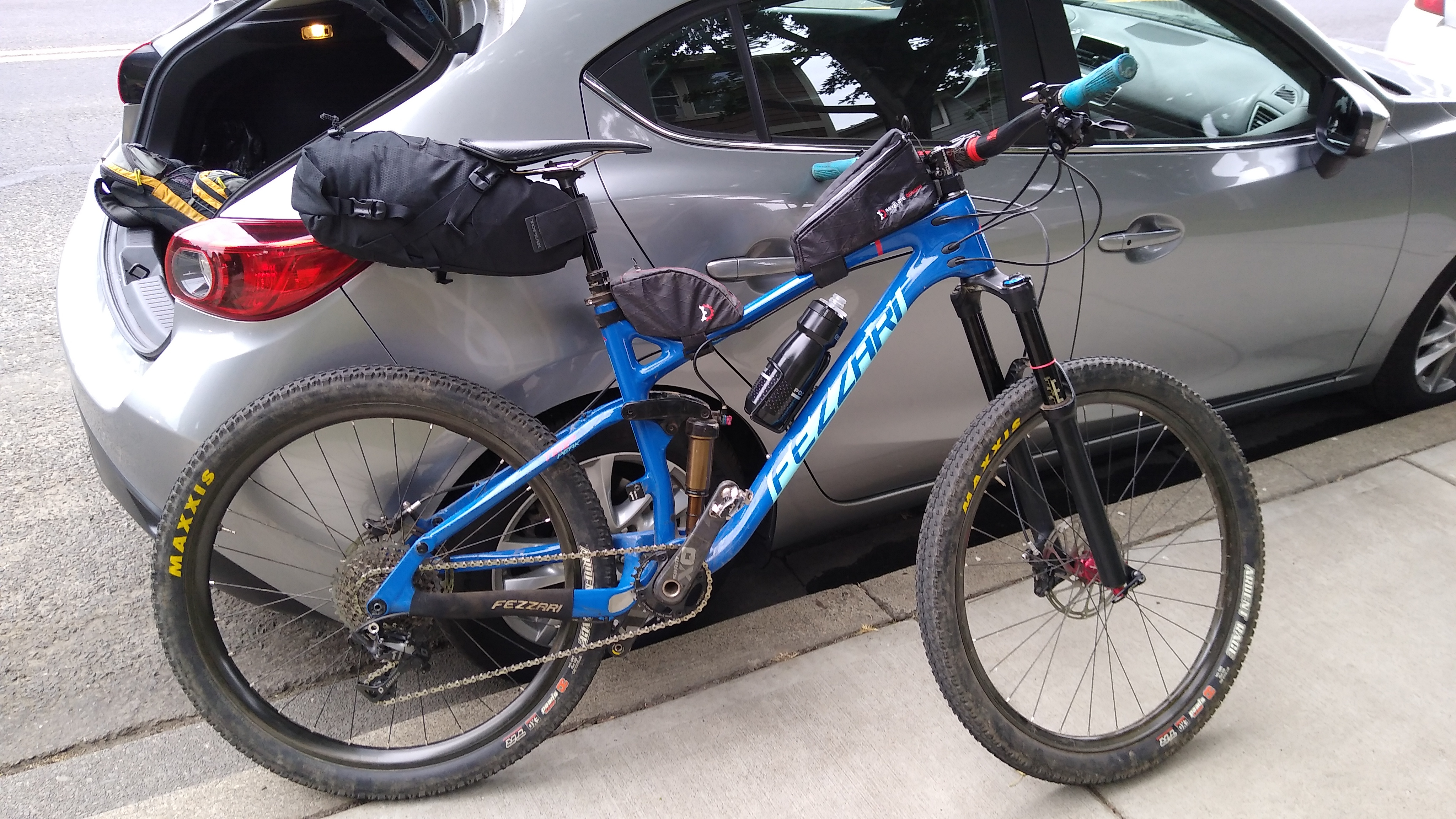
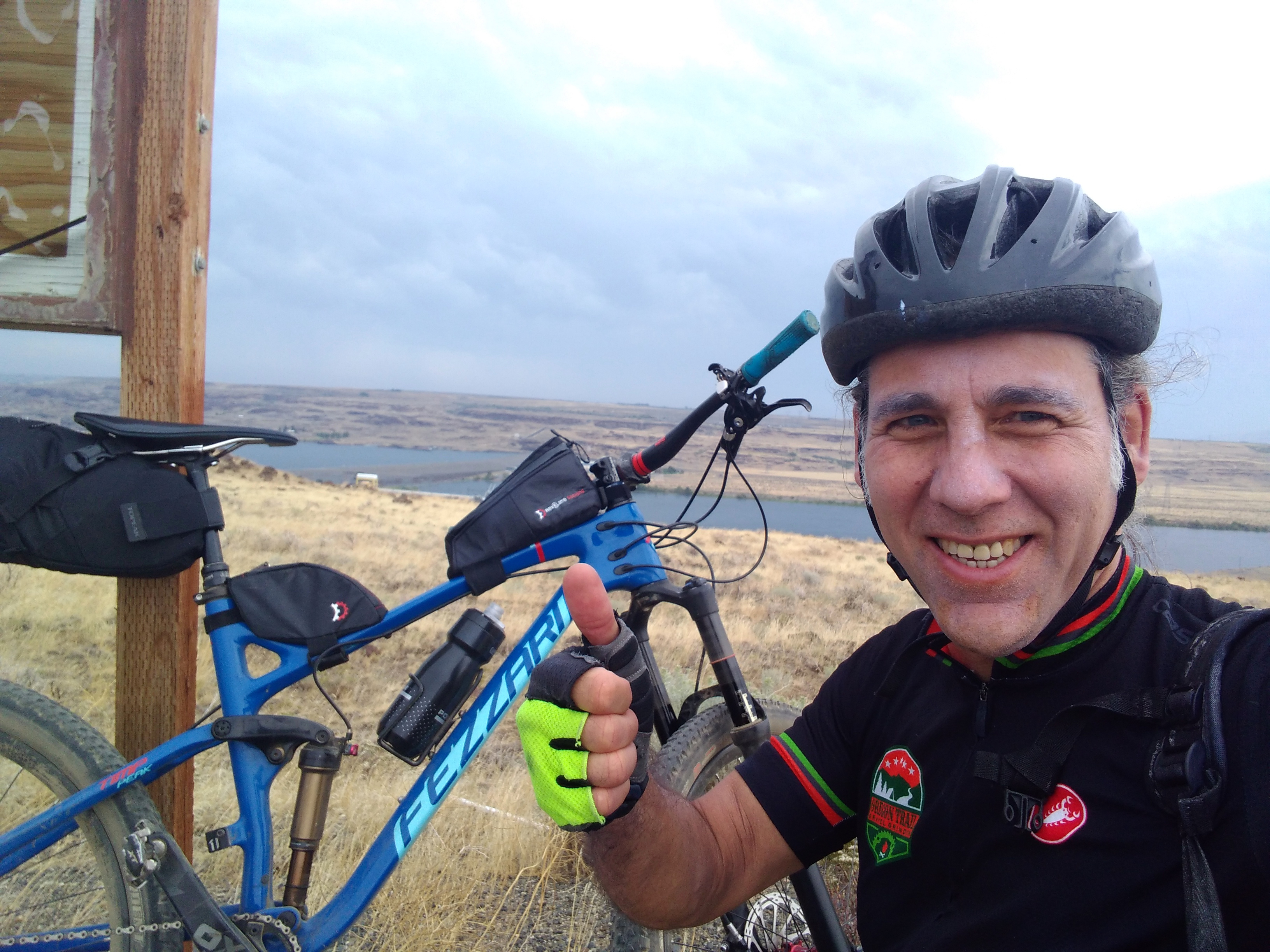
The bike, ready to go:
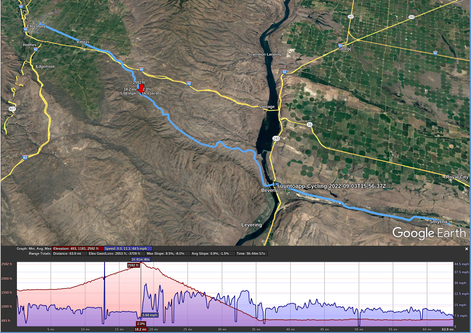
The JWT in Ellensburg is about 1600′ elevation. The first 8 miles or so is pretty flat. Then it starts a gentle, gradual climb to 2600′ about mile 18.
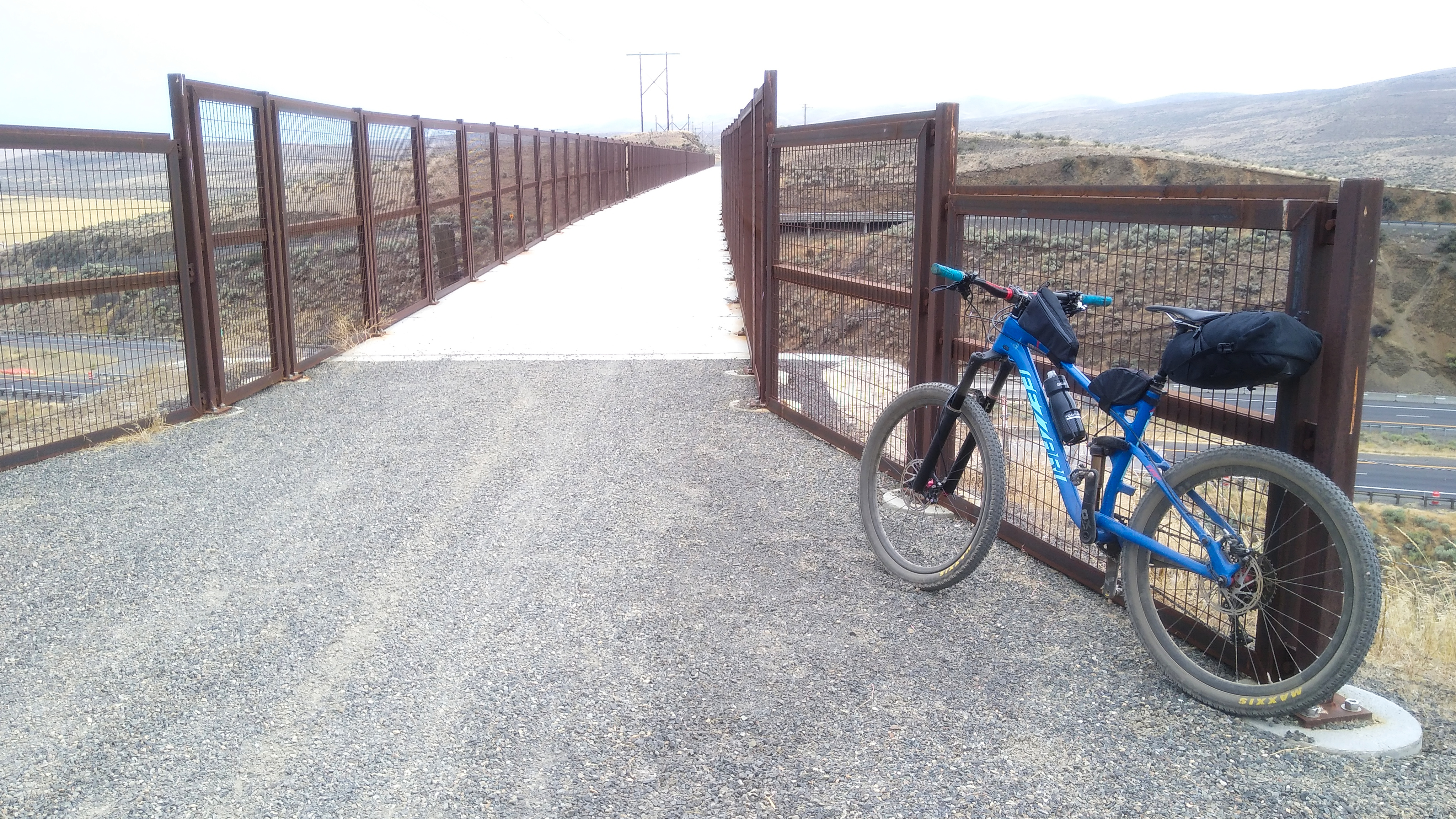
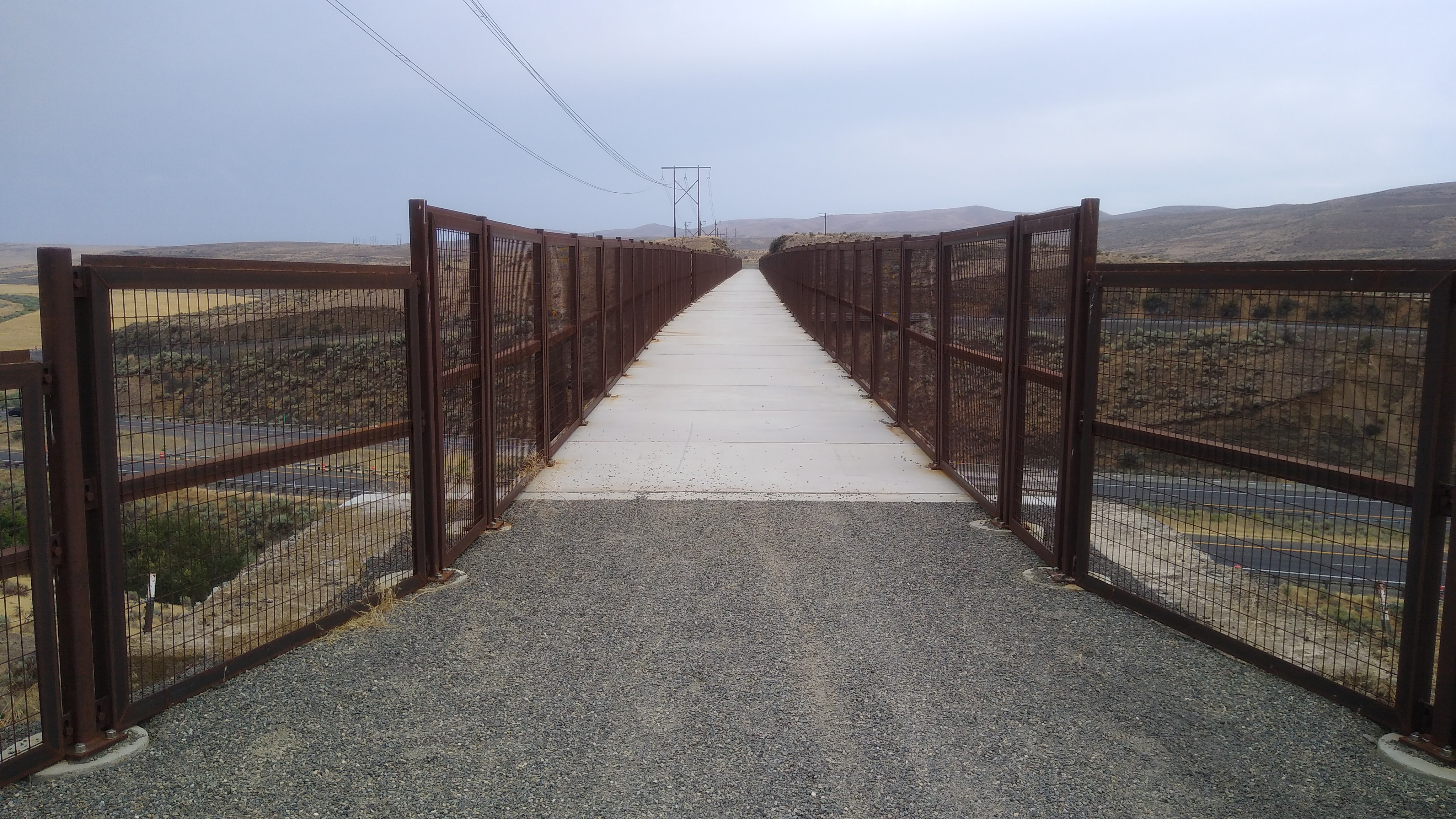
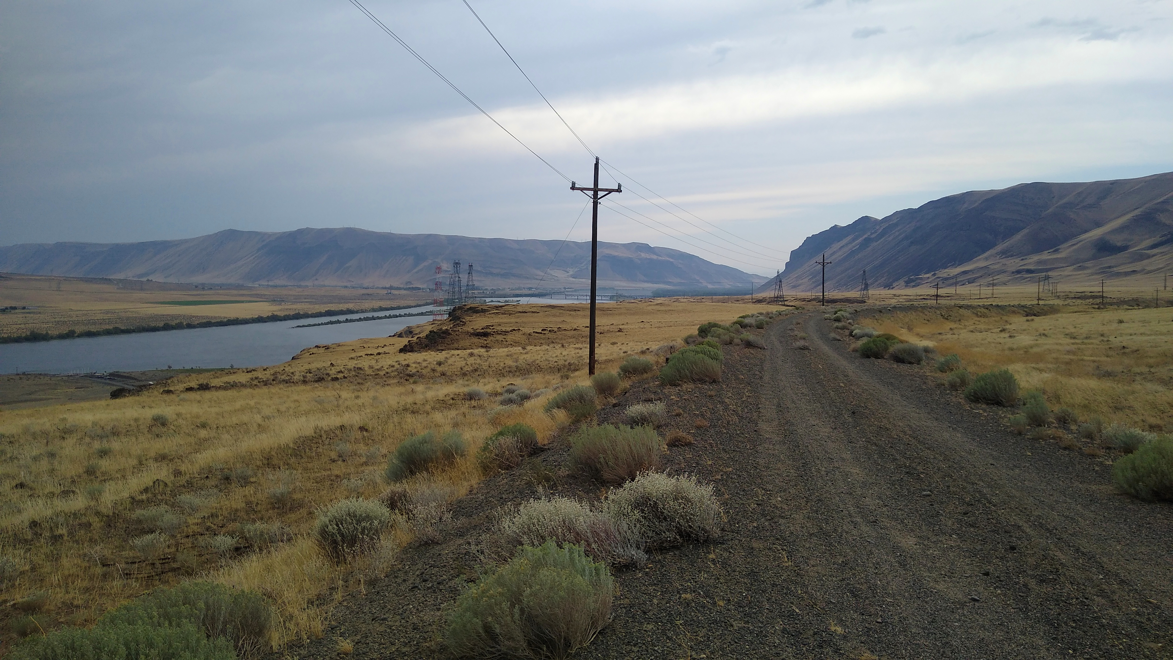
The JWT passed through a few houses and ranches, then got more remote. About 1 hour into the ride is a bridge crossing the freeway:
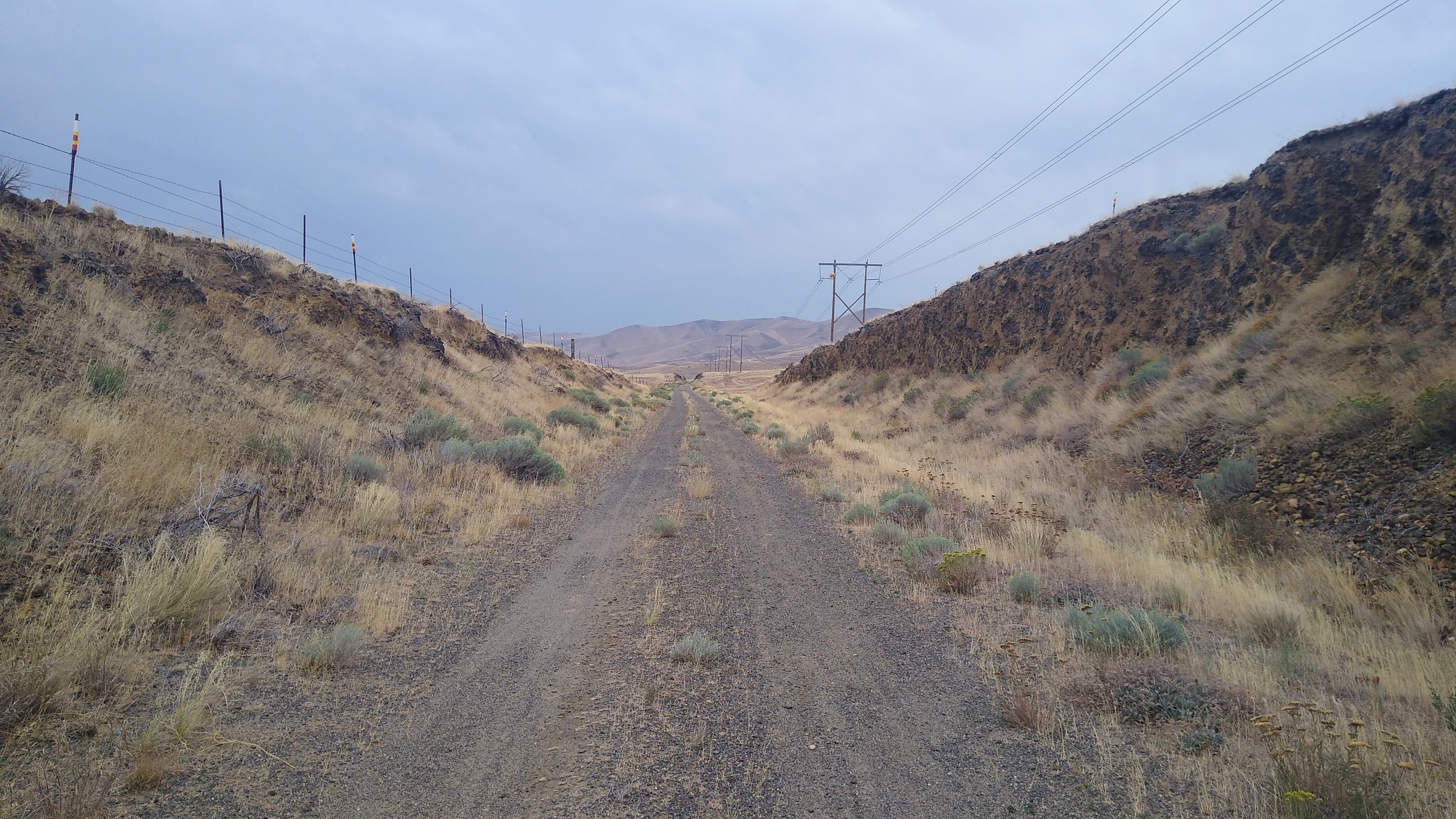
The trail surface varied between gravel and dirt, mostly hard packed and fast, with a few sections that were softer (sand or loose gravel) and slower, harder effort to overcome the tires sinking into the surface. I recommend having at least 45 mm wide tires, wider is better. My tires are Maxxis Ardent Race 27.5×2.2 or 584-56. They slid and sank a bit, but were manageable. I wouldn’t want anything narrower.
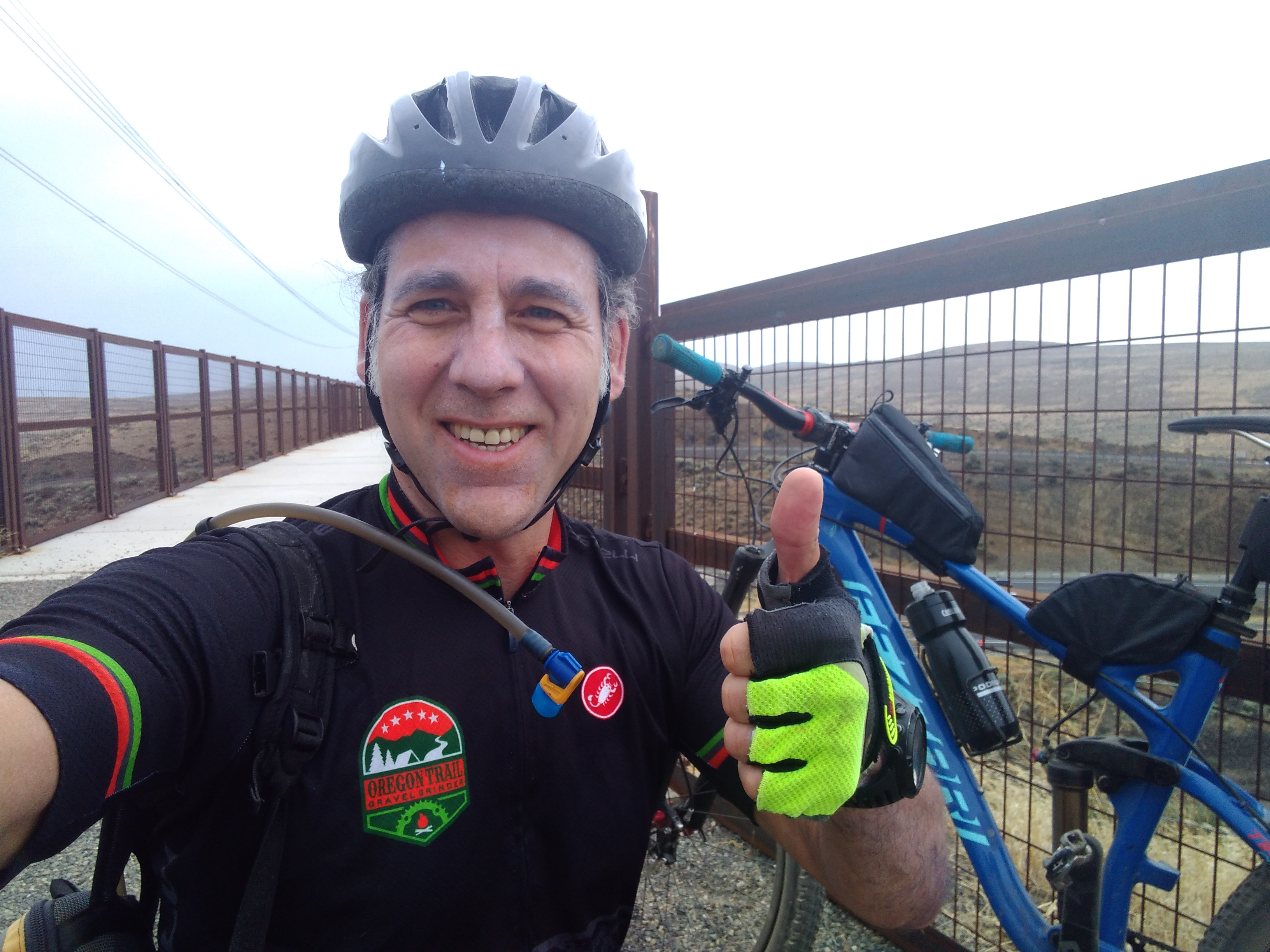
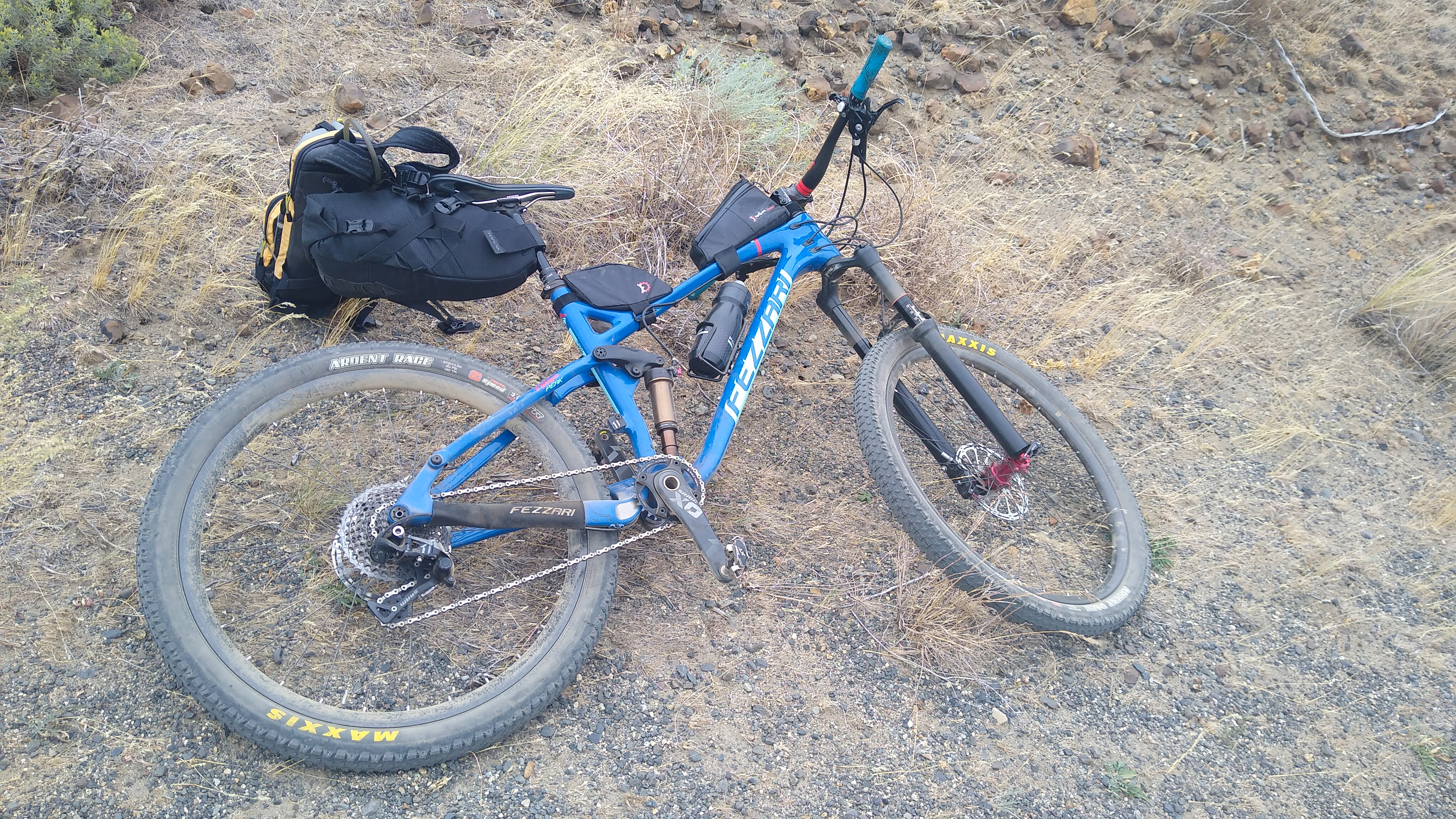
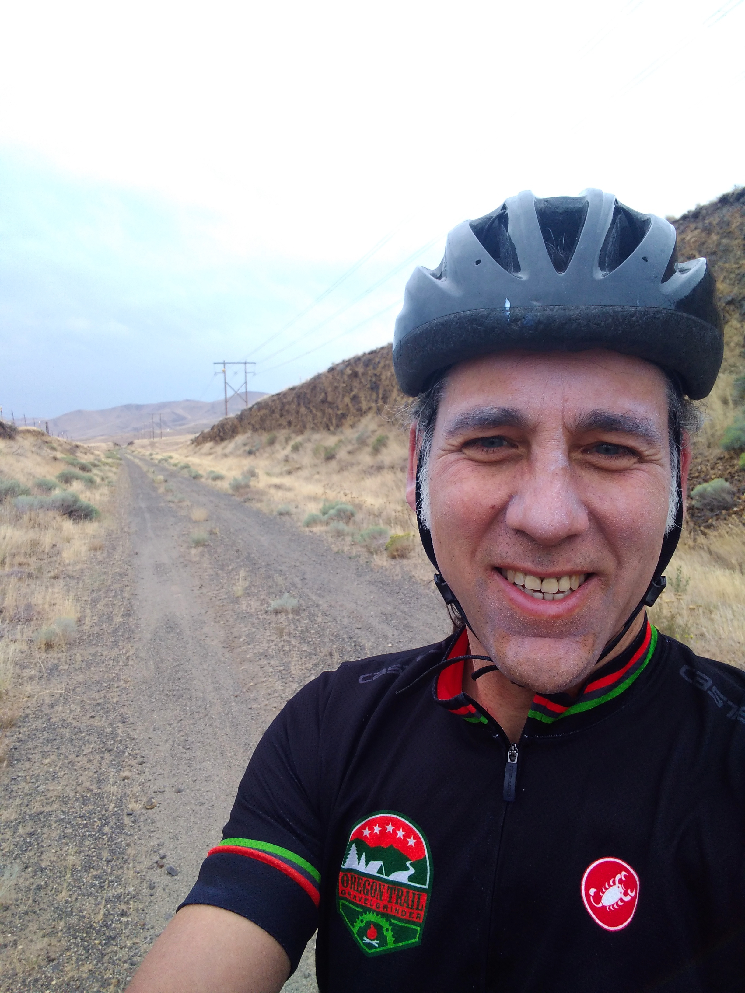
About 1 hour later I stopped for another bite and took a few more photos.
The trail:
The bike:
The rider:
Columbia River / Beverly Bridge
Leaving Ellensburg, the JWT climbs from 1600′ to a peak of 2600′ at about mile 18. From mile 18 to mile 35, where you reach the Columbia River, it gradually descends to about 500′. That’s a 17 mile gradual descent, very fun going East, especially since prevailing winds are from the West, and today was very windy, 20-30 mph. When the trail turned N or S, the wind gusts would exceed my tire traction and start blowing me across the road! But it was mostly a tailwind.
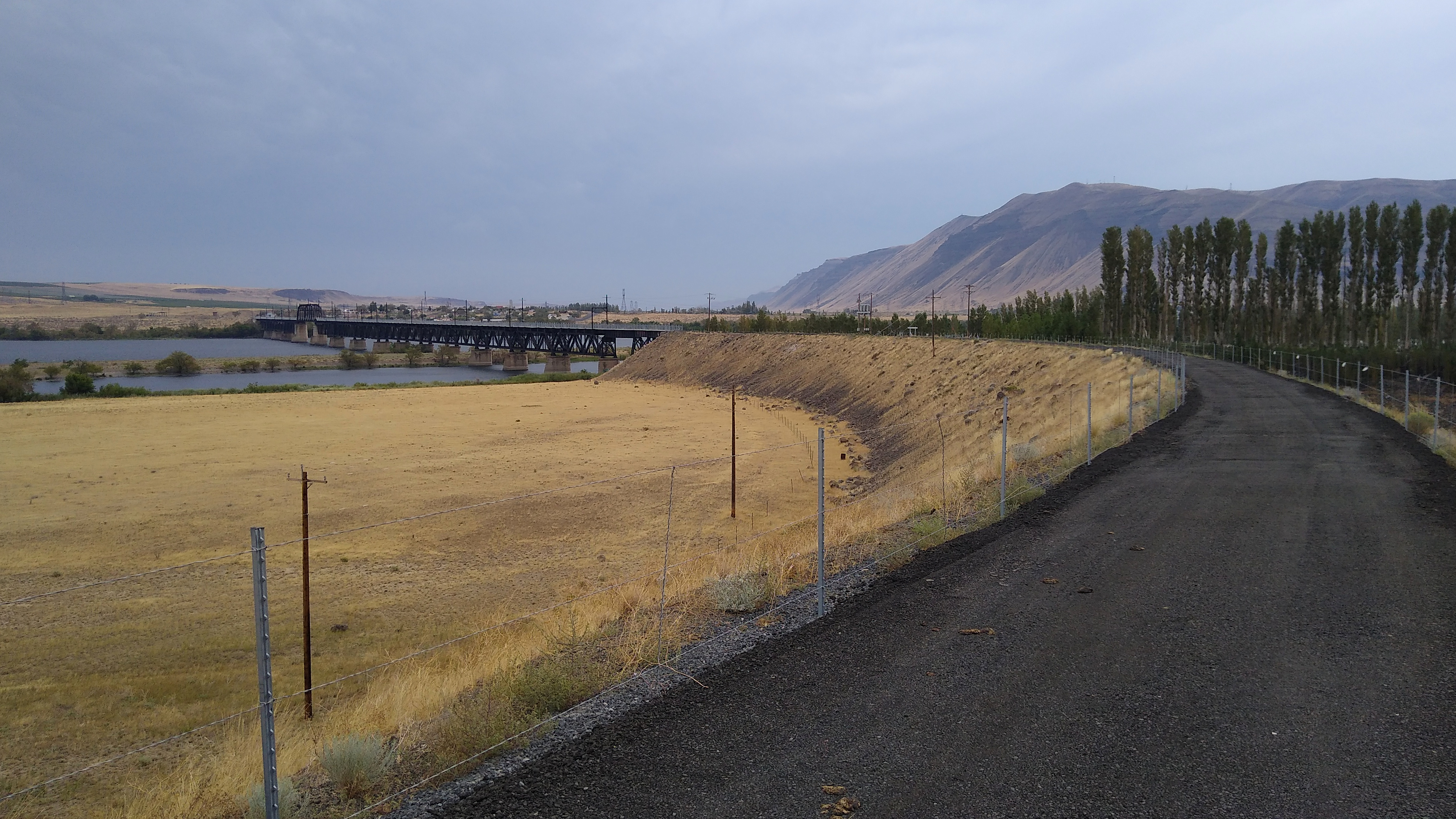
30 minutes later, or about 2.5 hours into the ride, I got my first glimpse of the Beverly bridge in the distance:
Still feeling great!
The bridge closer up, ready to cross:
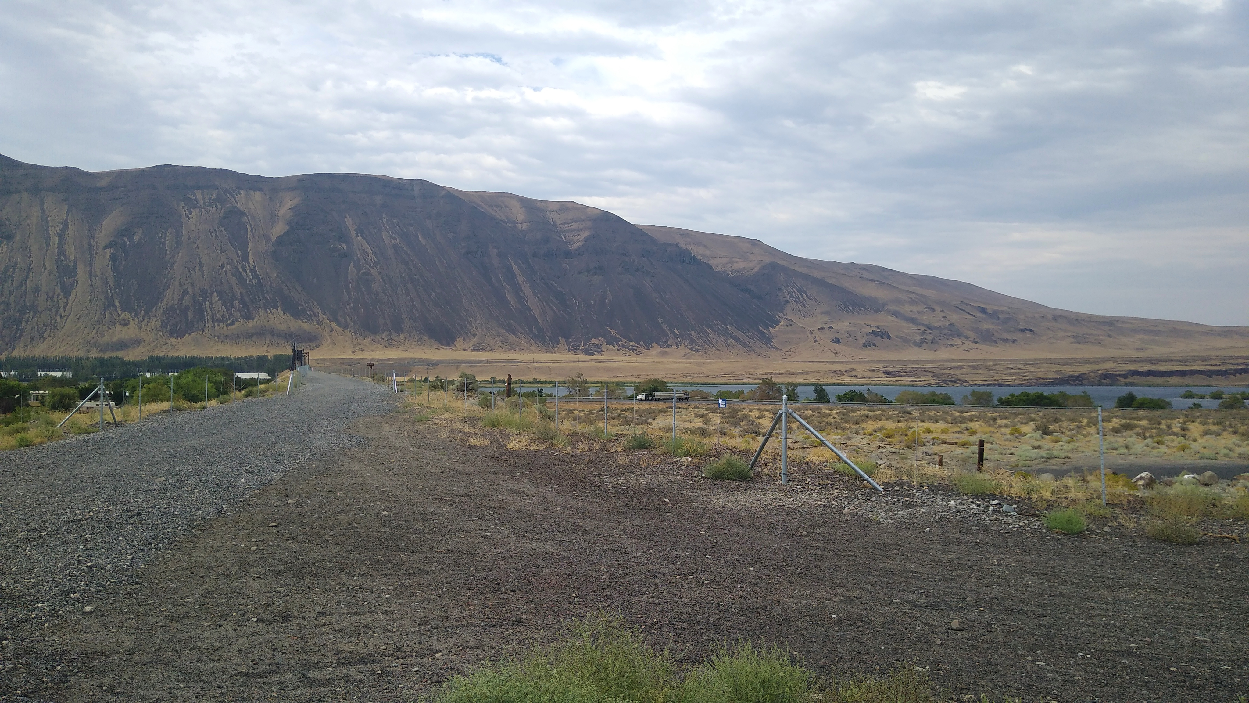
It’s about 1/2 mile across and the wind just rips down the river, so one is riding in a straight line while leaned over. Looking back after crossing:
Beverly is not much of a town. No motels, no stores. Just a few residents who drive to nearby towns for any services.
My Bike Breaks (again)!
I continued East for another 15 miles. Then, upon reaching mile 50, my pedals suddenly felt like they hit something. I backpedaled a bit then they worked again. I figured a small rock jumped up into the chain and hit the derailleur. But then the derailleur wasn’t shifting right either. I stopped to check it out.
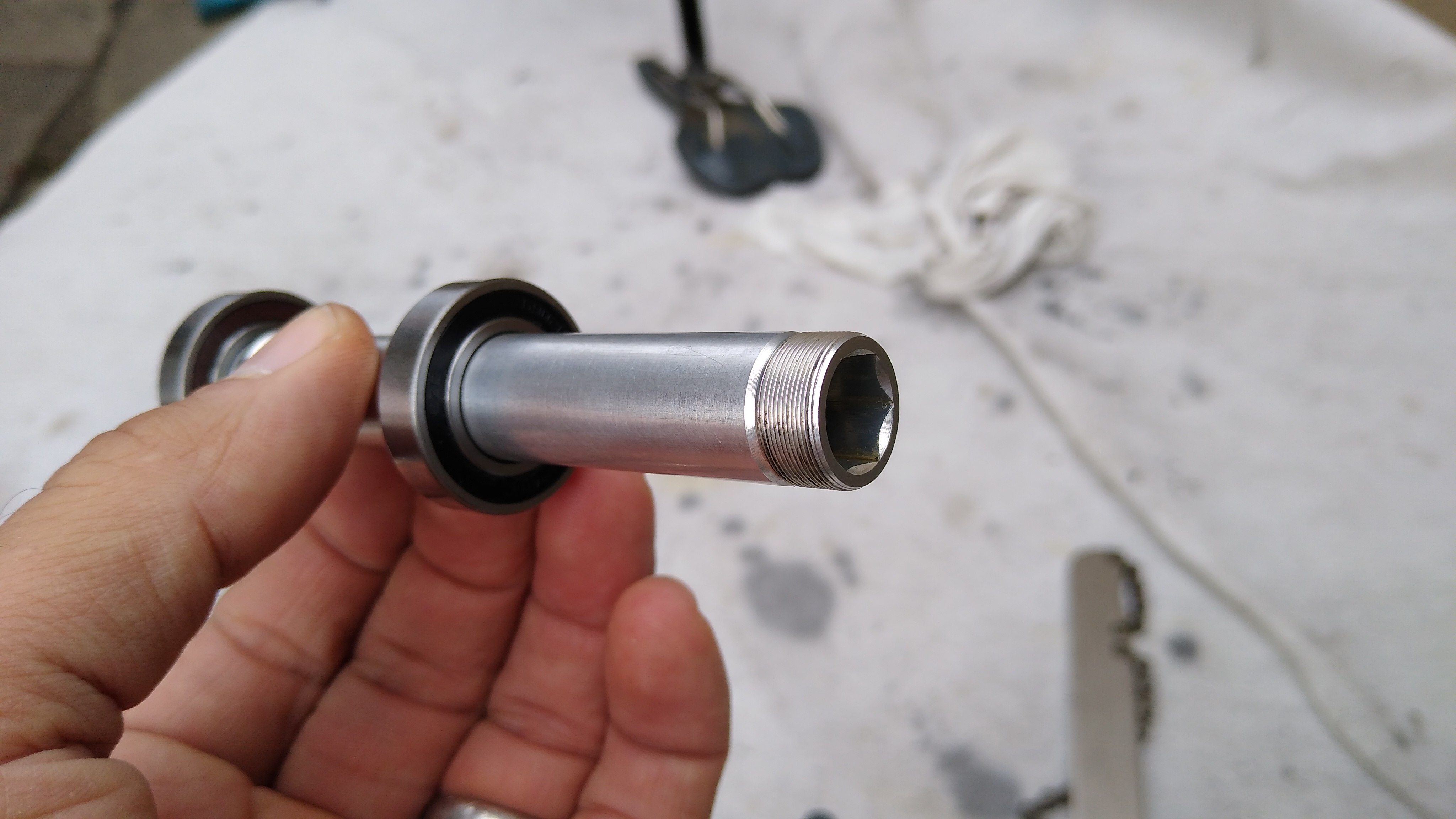
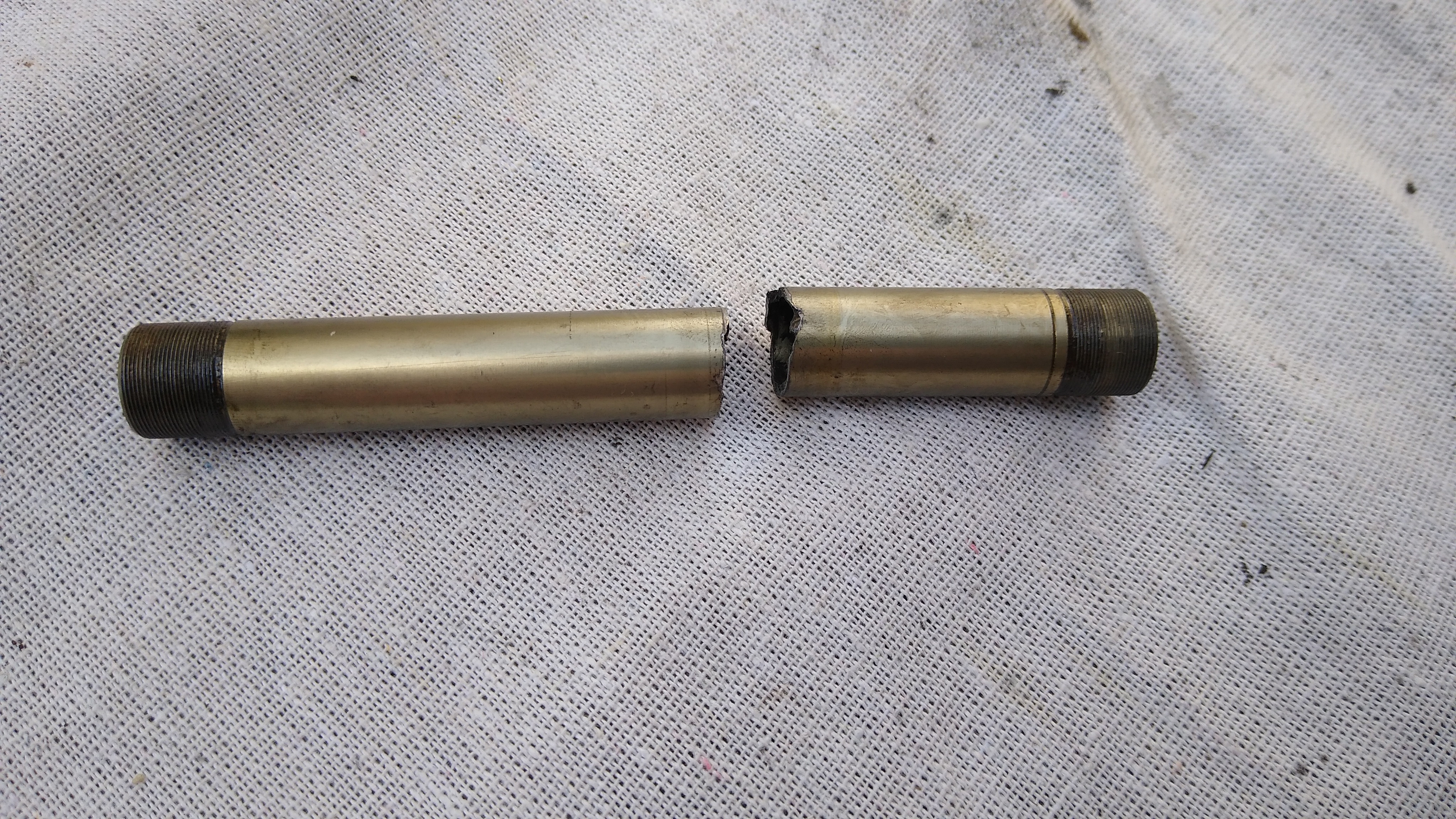
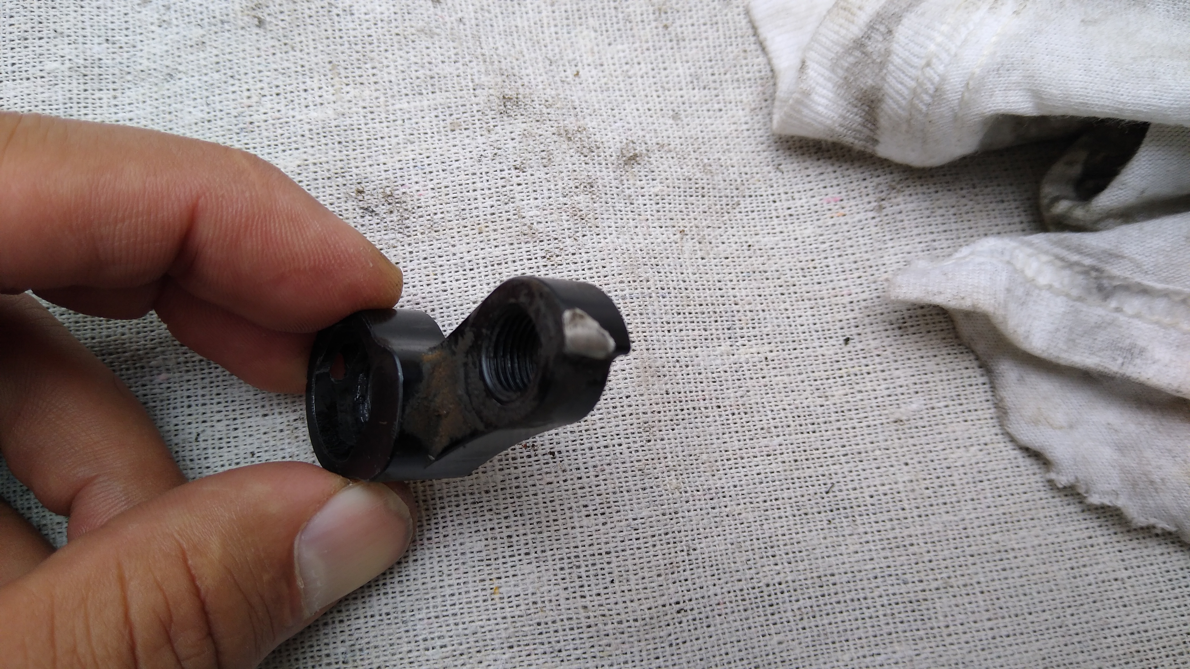
Long story short: the bike’s rear axle snapped in half! It has a through-axle, and the hub axle (12mm inner diameter) snapped in half, while the quick release (12mm outer diameter) that goes through it was still in 1 piece. The derailleur hanger’s end stop was also sheared off, so the derailleur was trying to swing forward. I had a replacement hanger in my bag, but I couldn’t install it because the inner bolt that secures the derailleur to the hanger, which looked like an allen, was actually a torx, which I didn’t have. I was able to jerry-rig it in place with the “b” screw. I was also able to line up the broken halves of the axle and reassemble the wheel with the quick release holding it all together. The wheel spun properly with no play, the freewheel worked, it was rideable. Of course, the broken axle put the quick release shaft under greater stress, and with both the axle & derailleur MacGyvered, I knew it wouldn’t be many miles before one of them broke permanently. At that point I would be walking.
Othello is a real town with some services, but it was 25 miles ahead. Beverly has nothing, but it is only 15 miles back. I opted to go back. That was one of the longest 15 miles I’ve ridden: into a 20-30 mph headwind, on soft dirt/gravel, anticipating the sudden snap of the quick release or derailleur breaking, at which point I would be walking.
Along the way back, I finished the 100 oz of water in the Camelbak and switched to my water bottle. I arrived in Beverly around 2:45pm. At least my phone worked (thank you T-Mobile!). First I rode by the fire dept. but nobody was there. Then I stopped by the residence of some locals and asked them about services. No Uber, no Lyft, nearest taxi service is in Pullman. I called Othello to cancel my room, told them what happened. Due to my circumstances, they waived the cancellation fee. I called my wife in Seattle and she agreed to drive all the way out there to pick me up, as a plan B if I couldn’t wrangle a ride from locals. At the residence, the dad (Reynaldo) who only spoke Spanish gave me some water and his son (Jerry) was talking to me about my bike. It looked like they were just relaxing for the afternoon, not too busy, and he had a small pickup truck, so I asked the dad if I could pay him to drive me to Ellensburg. He said sure, as long as I paid for the gas. I told him thanks, and also I’d pay him $100 too for his trouble. So Reynaldo, Jerry and I drove back to Ellensburg and they dropped me off at my car.
So that’s why I rode only 65 miles instead of 146 this weekend. And got stranded by my bike breaking in yet another new way.
The Aftermath
The route, with elevation profile. The red marker is the peak elevation (2600′).
The broken axle
The sheared derailleur hanger
The new axle that Reynolds shipped me a year or two ago (it came with the pawls I had to replace), which doesn’t fit because it’s made for traditional quick-release not through-axle.