This is the last day of a trip to Alaska, part 12 of 12. Click here for the prior entry, here for the introduction.
I wanted a good meal so Dave and I hit the local W for breakfast. The don’t have a website, but they did make a good vegetarian omelette with great crispy cubed taters even if the coffee was weak.
Back at the hotel, I used their office space to get a weather briefing. Bad weather was still covering the Trench, but it was clearing out in parts so I would check again around 11am. Meanwhile, I read Yukon Wings, the book Bernd got me for my birthday. It’s a great book, and mine is signed by the author.
At 11, the weather looked better. We could definitely get to Prince George, and maybe Quesnel and Williams Lake. If not, we’d at least get over the mountains separating us from the Trench, and one step closer to home. I filed a flight plan to Williams Lake with an alternate for Quesnel. We checked out of the hotel, drove to the airport, and Bernd returned the car while I preflighted the plane and called the FBO to fuel us up.
We departed at 12:30 local time heading SW. Skies were mostly scattered, broken in isolated areas, at about 8,000′. This is enough for good VFR through the passes to Prince George.

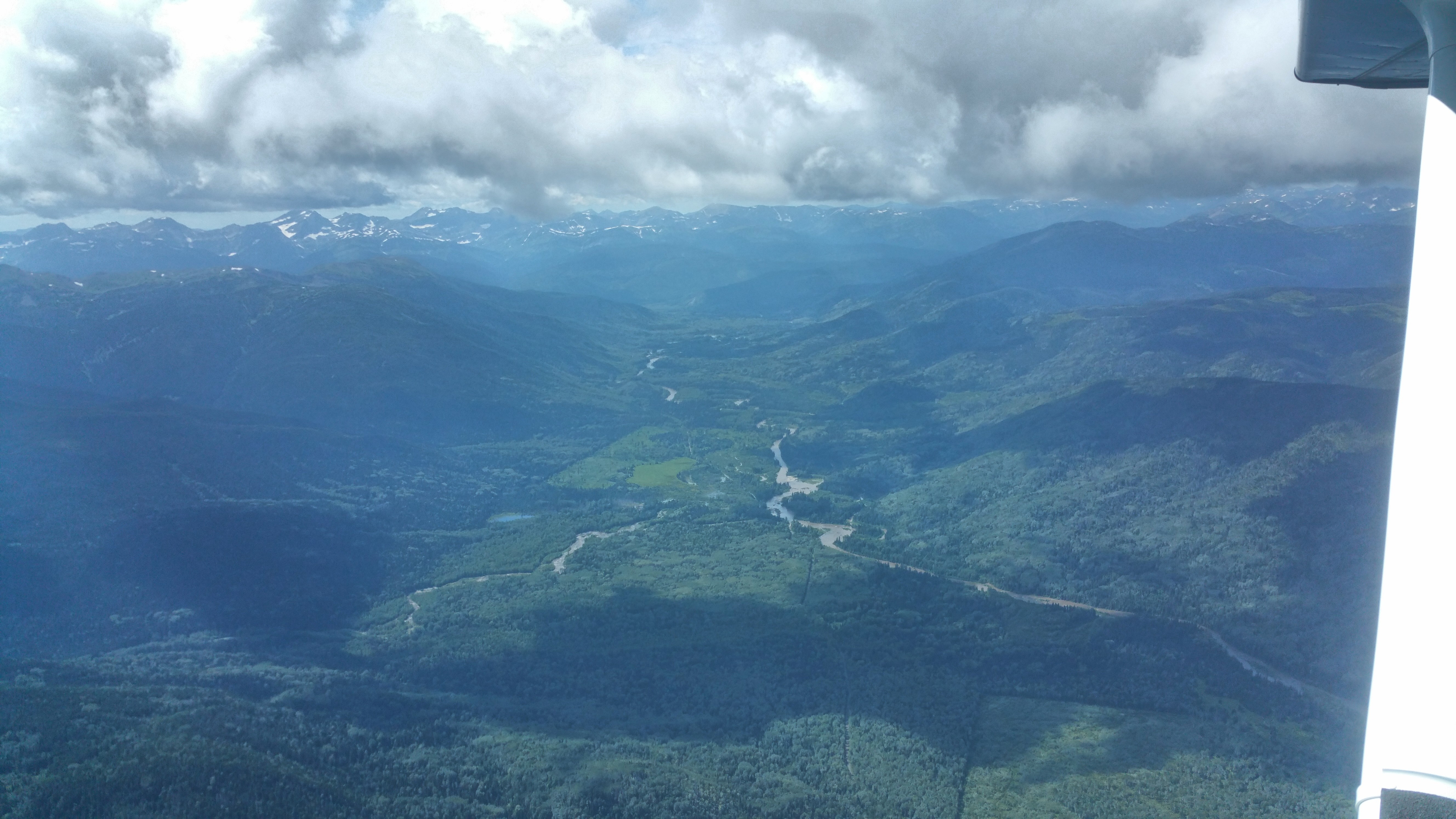
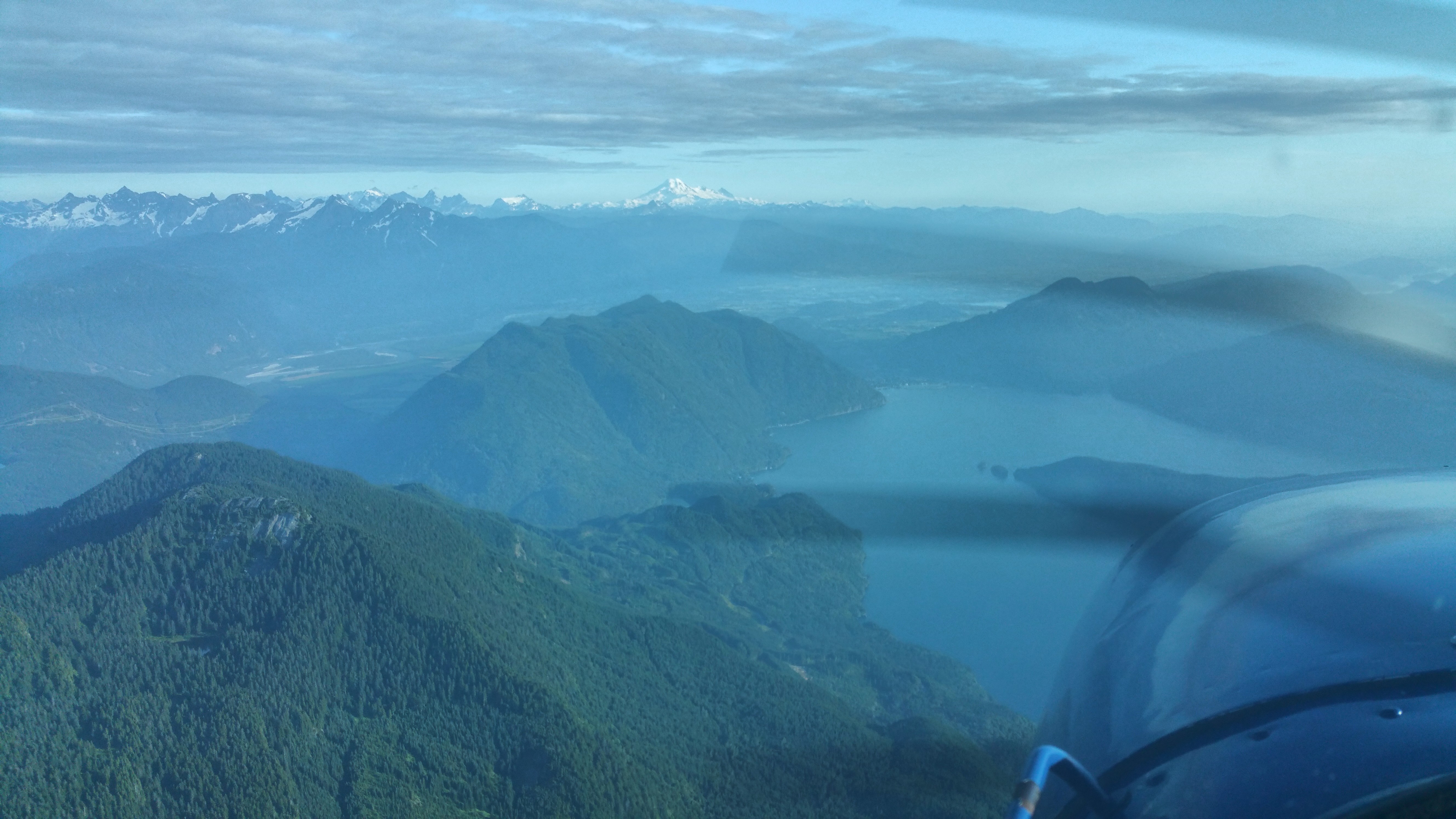
The flight over the mountains, into the trench and past Prince George was scenic though uneventful. As we turned S toward Quesnel we could see small isolated thunderstorms in the distance ahead. I wasn’t going to fly into that so as we flew over Quesnel I called their MF and reported I’d land there.
Here, I encountered a difference between US and Canadian procedures. Quesnel (CYQZ) is a non-towered airport at elevation 1,800′, so pattern altitude is 2,800′. They have a class E airspace that goes up to 4,800′. I flew over and announced mid-field at 4,500′. This is a safe, legal way to approach a non-towered airport in the US. Midfield, you don’t conflict with arriving or departing traffic, and 1,700′ above pattern altitude puts you high enough to avoid conflicts with anyone in the pattern. And approaching from that height and direction, you have great visibility for any other planes in the area so you can smoothly merge into the pattern. However, in response to my radio call, the Canadian RCO berated me, saying I violated their airspace and should announce at least 5 miles out. They asked did I have a CFS on board? I assumed they meant a Canadian Flight Supplement and replied “affirmative”. Then the RCO said there were no other airplanes in the area so it did not cause any separation issues, don’t worry about it. I resisted the urge to reply that was obvious because from mid-field, 1,700′ above pattern at a non-towered airport, I was looking out for myself and could see that. Instead, I kept my mouth shut. “Nothing” is often a wise thing to say.
After I landed a local Canadian pilot walked up to my airplane, said he was listening on his radio, that I did nothing wrong, that RCO had been chewing out pilots for no good reason. He was going to call the RCO and complain about their poor service. I told him I was a visitor in their country and despite having studied the differences in US-Canada flight procedures, I could have missed something. I don’t know who was right: this friendly pilot or the RCO, so I’ll consider it a lesson learned: in Canada, the RCOs want you to announce before entering the class E area of an airport, even when the airport is non-towered.
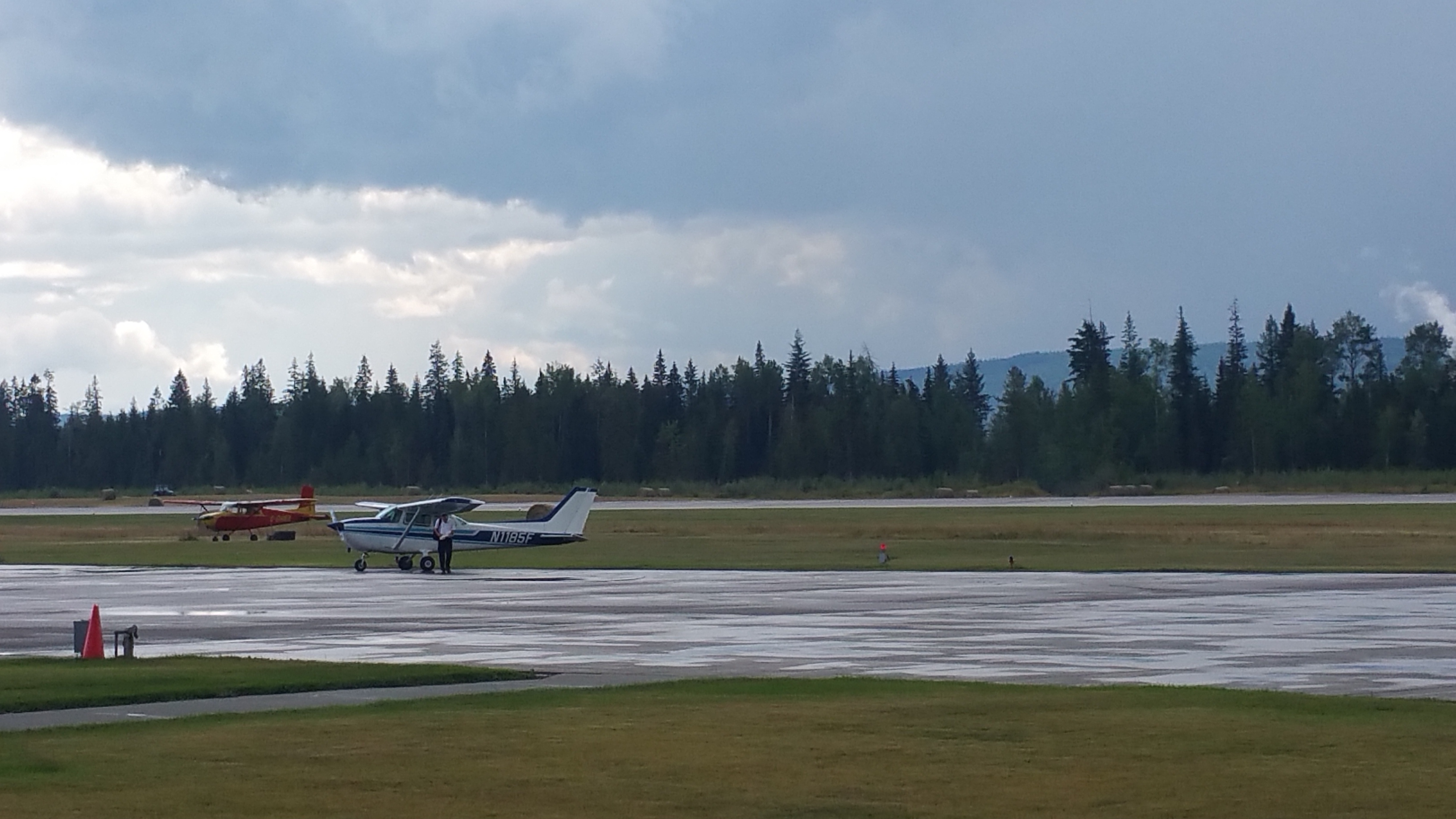
After landing, we refueled and parked. About 30 minutes later, one of those scattered t-storms came through and dumped an amount of heavy rain that belied its small size.
Flight time: H 89.6 – 91.6 = 2.0 hrs
Flight track: https://hangar.naviatorapp.com/20353/cyxj-to-cyqz
I called NavCanada to get a briefing. Wiliams Lake was socked in, MVFR, but if we could get past there, we’d have clear conditions through Hope, Abbotsford and to Seattle. We decided to wait a couple of hours in Quesnel and check again. They have a nice pilot lounge so worst case, we could stay there for the night. We ordered a pizza and charged our devices while waiting.
The second weather briefing for Williams Lake looked better; the weather was moving to the E. And, 2 pilots entered the lounge on their way to Atlin. They had flown N from where we were going. They were older guys, experienced with the area. The pilot was a former FAA inspector. They said conditions were OK and we’d pass by just fine.
Armed with this knowledge, I filed an international flight plan from Quesnel to Williams Lake, Hope, Abbotsford, then Seattle. The prior day I had filed the EAPIS. I called Seattle customs for our arrival notification. Then we departed at 5:30pm expecting to arrive in Seattle at 9:30pm. We’d be early if I could cut the corner and skip Hope. Seemed like we’d been gone a long time, felt strange to imagine being back in Seattle.
Over the phone, the NavCanada briefer gave me a discrete squawk code to cross the border. After takeoff, the RCO gave me a different squawk code. I told him the briefer had given me another one. The RCO said that is unusual, they usually don’t do that. He couldn’t find the other code in the system so I went with his code 0022.
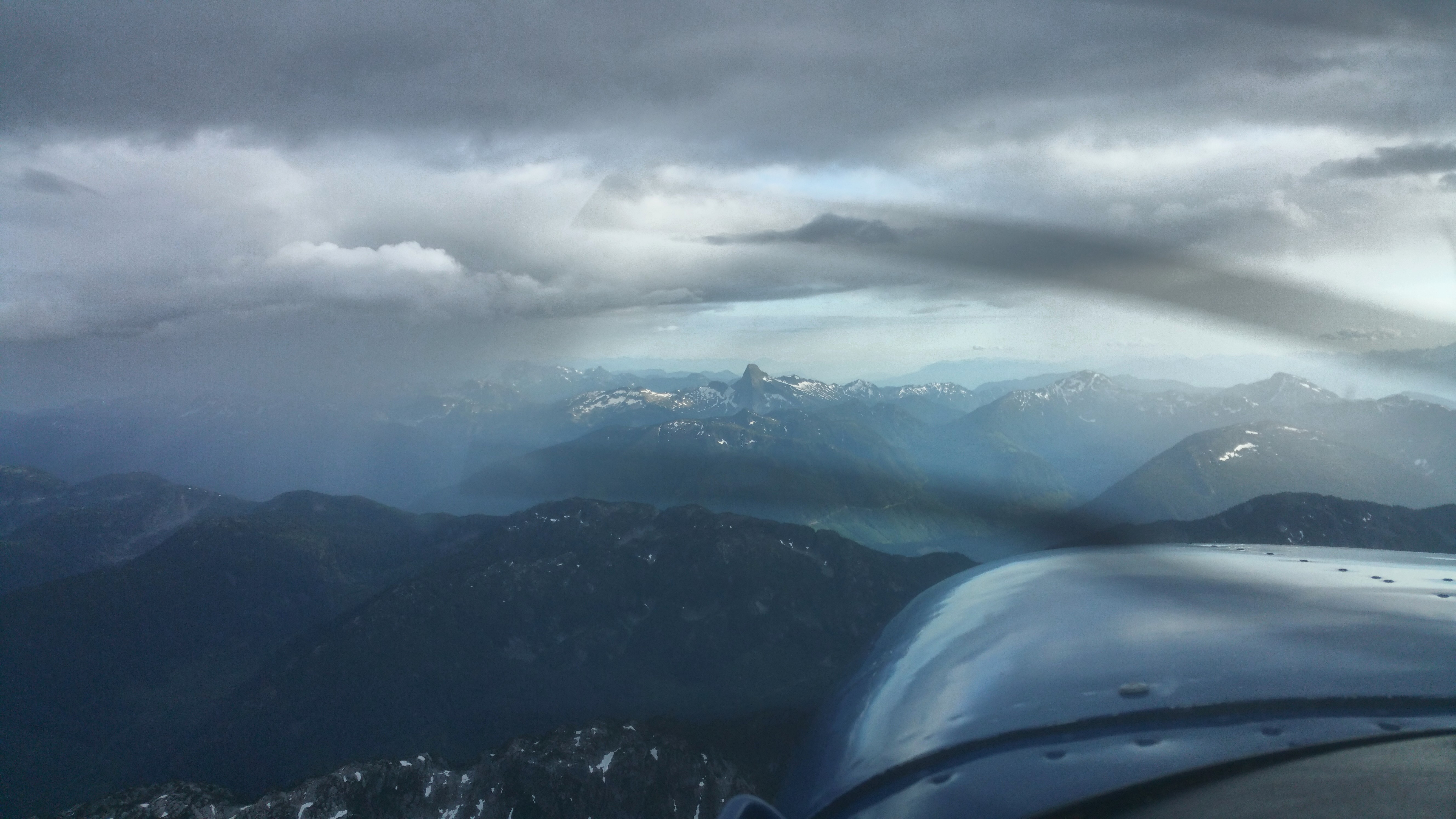

Once again, the flight was scenic yet uneventful. Since the leg was over 3 hours, I slowed down to medium power cruise for efficiency (2400 RPM) which gives over 5 hours of flight.
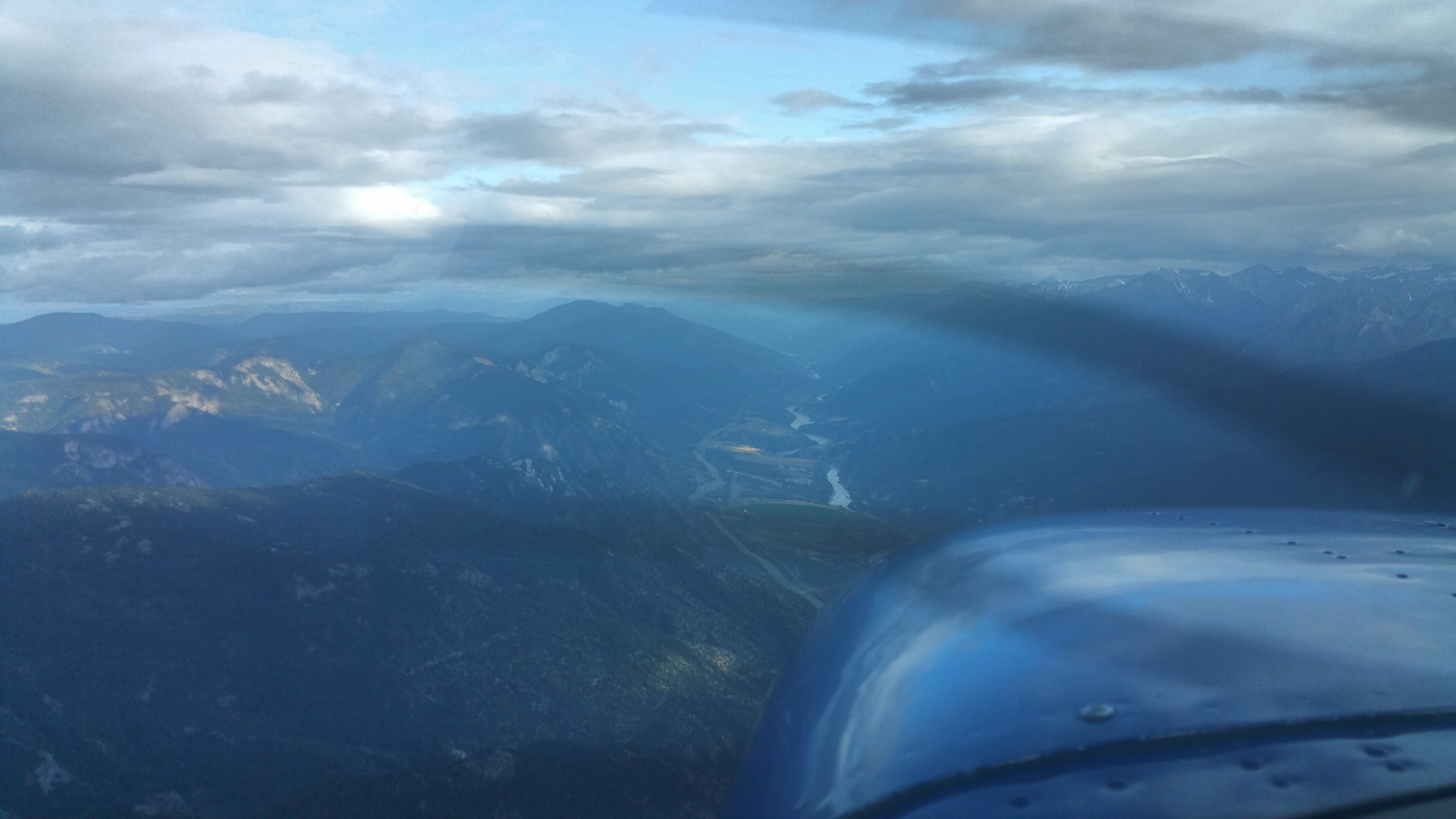
The long way is to follow the Fraser river all the way around to Hope then back to the W. This avoids the high altitudes needed to cross the northern Rockies. The short way is to cut the corner. On this day the SE end of the Fraser river was socked in with bad weather so we cut the corner through clear skies.
I called Abbotsford tower as we approached; they cleared us through their class C airspace (same female controller we had on Day 1, with the great sounding Australian accent) and handed us off to Victoria Approach to cross the border.
Then we transferred to Whidbey Approach, after that cancelled flight following and continued direct to Boeing Field. We landed a few minutes ahead of schedule. Customs met us and the processing was quick and efficient. Taxi-ing back to NE parking, BFI ground didn’t reply to my radio call. Then the ground controller got grouchy with myself and several other aircraft and made several mistakes, mixing up our tail numbers and locations. Seems like he fell behind in whatever he was doing and was frustrated trying to catch up. No problem, we got our taxi clearance, tied down, unloaded and ended our 2-week adventure.
Flight time: H 91.6 – 94.8 = 3.2 hours
Flight tracks:
https://hangar.naviatorapp.com/20352/cyqz-to-wn51
https://hangar.naviatorapp.com/20351/wn51-to-wn93
Total flight time: H 59.7 – 94.8 = 35.1 hours